Tuesday, March 31, 2015

Big LBJ and Big Bend

Jo swings under the live oaks along the Pedernales River. Her swing faces LBJ's Texas White House.


Farmer Sam Nail and his wife carved out a little piece of paradise in the desert. Walls of his house were made from adobe. They stayed alive with the help of a windmill, pumping water.

There’s a world of difference between the Texas hill country of Lyndon B. Johnson’s ranch in Stonewall and the naked, almost brutal landscape of  the Big Bend National Park, south along the Rio Grande River.

It’s easy to understand LBJ’s love for the hill country – those lush and ancient live oaks, the mesquite trees (the locals call all this wood barbecue wood!). And there’s water, too. The Pedernales River, not mighty but seemingly ever-flowing, wanders past the ranch, providing sustenance to the farmlands.

Down the road 250 miles, approaching Big Bend, we have left all civilization behind. There’s no wi-fi, no television reception, no cellphone here. You are under an all-encompassing blue sky and an unforgiving sun.  We parked our rig alongside the road in a picnic area. We’re living off the sun. Last night, we stayed in a free county park in Sonora, TX, and slept the night away in utter peace. Now we wander the scrubby landscape, marveling at the similarity between this hardscrabble lands and the deserts of Namibia in Africa.  The mesas, sometimes flat-topped, sometimes conical as though they are volcanoes, make up the distant horizon. Windmills, hundreds of them, line the horizon to generate electricity as we drive across the ribbon of concrete that is Interstate 10.

Two days ago, we walked through the Texas White House. It has been restored to the way it looked back in the 1960s – which means a remarkable amount of yellow Formica, almond-colored refrigerators and Herculon seating. LBJ’s bedroom is a masterpiece of 60s modern tech. He had his three TV sets across the room. He had Muzak buttons he could push for different mood music. He had telephones everywhere (under the dining room table, in the kitchen, in the bedroom, the bathroom, library. Ladybird’s bedroom, meanwhile, is devoid of all this hi-tech stuff. She has a book by Larry McMurtry lying on her bed. Her closet is filled with the clothing of the 60s.
In the office where LBJ worked, there’s a Naugahyde recliner chair with the insignia of the president of the U.S. embedded on it. And a cushion is embroidered with the words, “What I love about being here is it is my place and I’ll do what I damn well please.”

Now, as we sit on the side of a hill with wild flowers poking their way through the stony ground, we are in a different world. It is a land that is light on water. When we enter Big Bend National Park we are  warned that we should bring the water we will consume into the park. Otherwise we’ll be rationed to five gallons per day.
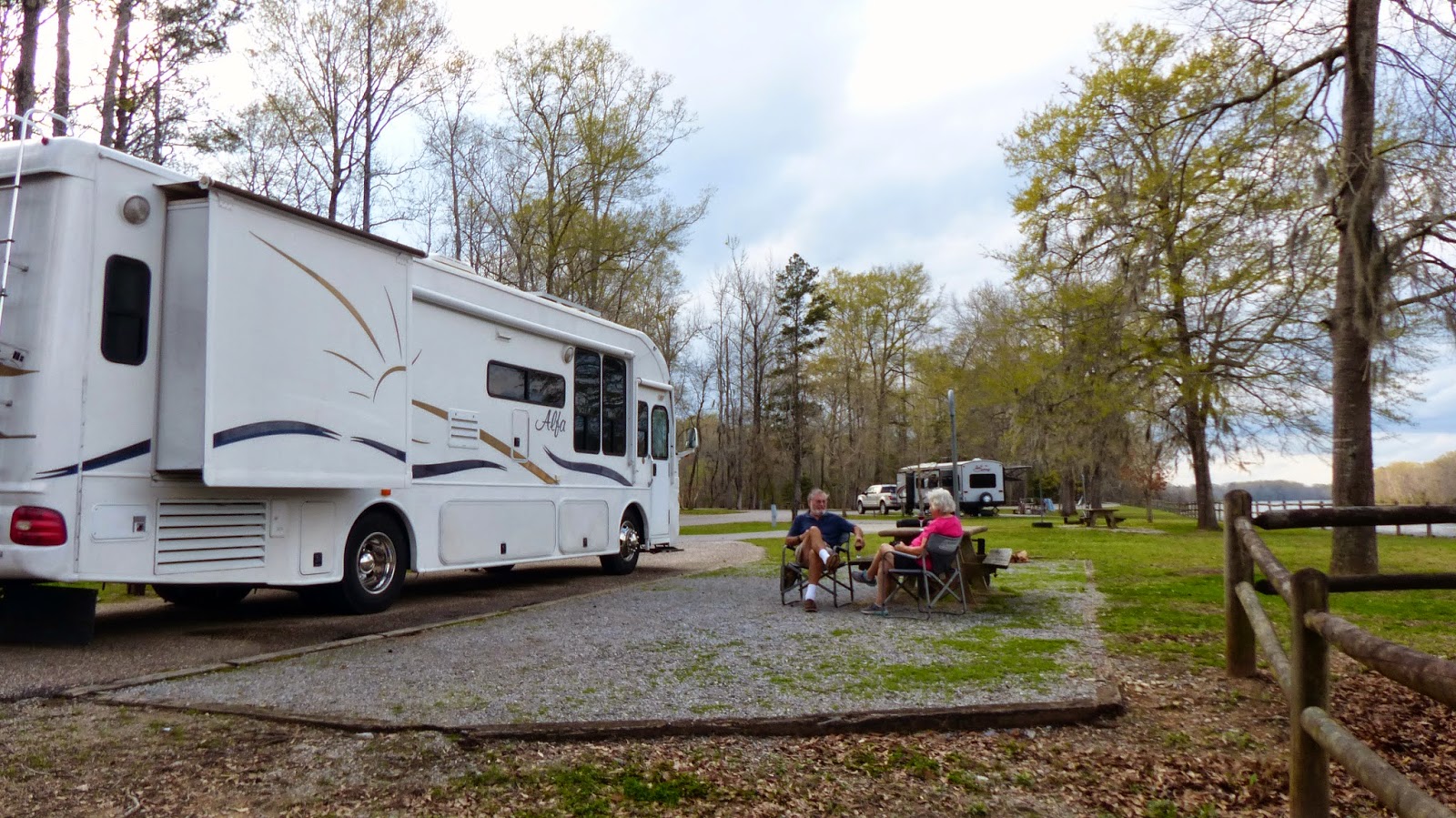
We cannot park our rig inside the park because the sites don’t accommodate anything larger than 24 feet. So we’ve had to book into a commercial campground outside the western edge of the park. 

After settling in at a dusty (and too-expensive RV park), we get in the card and head back into the park. We’d stopped at the Ranger station and a young woman gave us good advice about the places we need to seek out. As a result, we are heading for the Rio Grande River at Santa Elena Canyon. The cliffs are staggering in their nakedness and inaccessibility.

We stop by a sign that tells us Sam Nail and his wife, Nena, operated a farm here. We walk along the stony path to the remains of the adobe house.  There are pecan and fig trees. Sam had some livestock and a precious windmill still works a hundred years later. The blades were being turned by the light breeze. The shaft rose and fell about a foot. And up came the water. It poured, a pint at a time, from the earth. This precious water made the difference between life and death in this arid land.

We came to the canyon after a 30-mile drive through the desert, most of it downhill. We walked the trail to the river, finding gangling boys from Tulane University standing in the their bare feet in the mud of the river. I dodge the mud and then we decided to walk up river a bit. We found a ford that let us make it up a bank, still on the American side. We clambered along an eroding bank and then came upon concrete steps that allowed us to climb high above the river. A handful of people were there, but there was very little sign of wildlife. Millions of cacti, of course – and much of it in full bloom.

I photographed to my heart’s content while Jo rested on the halfway point of the steps. We met up with a Canadian couple from Sault Ste. Marie, Ontario. He was excited about spotting 15 turtles swimming in the Rio Grande, close to the Mexican shore. The river, incidentally, seems like a passive thing. It meanders along, muddy-colored and gentle. It takes great imagination to come to grips with the fact that it is responsible for carving its way through the several thousand-foot-high cliffs that make up this gorge. But it did. Of course its sweet time to do this over multiple millions of years.

We made our way back to the main road and drove uphill past a remarkable rock formation called The Mules Ears. Again, this was the result of erosion of the surrounding landscape, exposing these pillars of rock that look like they sound.
 
The Mule Ears stand stark and naked in the wilderness of Big Bend National Park.


Thursday, March 26, 2015

This is Huge

Jo stands at the entrance to the Mammoth dig site to give perspective to the massive Mammoth. The bull stands 14 feet high at the shoulder. His bones are in the foreground.
In 1978, two young men were looking for arrowheads in a ravine near the Bosque River in Waco, Texas. Instead, they stumbled on a lost world of Mammoth bones.

The men took one of the bones they found to Baylor University in the city and that resulted in a dig that went on for 10 years and uncovered a huge family of Mammoths, bulls, females and babies who had died in the mud by the river.

As the scientists gingerly chipped away at the remaining soil, they also uncovered a North American Camel – this is the fore-runner of the camels that currently wander the deserts of Africa and the Middle East. They are bigger than the modern camel but our guide, Eva, told us scientists believe they had made their way across the land-ice bridge to Asia. The diggers also uncovered a saber-toothed cat and numerous other creatures.

But back to our amazing Mammoths. These boys were spectacularly large – much larger than the African and Asian elephants that we know today.  A full-size painting of one is at the entrance to the dig and he stands 14 feet to the shoulder. The biggest tusks found at the site are 16 feet long and curly at the end.

These Mammoths lived 68,000 years ago and were grass eaters. They lived during the Ice Age. Waco, during that time, was south of the ice and our guide told us it was rolling grasslands with trees near the sides of rivers.  

Their molars were massive things – about the size of shoeboxes. Just as today’s elephants come to the end of their lives when they lose their molars and can no longer chew their food, the Mammoths suffered from the same process. They had six sets of molars to last their lifetime, Eva told us. And when the last set ground down to nubs, the Mammoths were around 80 years of age.

Based on studies of their close relatives, the modern elephants, mammoths probably had a gestation period of 22 months, resulting in a single calf being born. Their social structure was probably the same as that of African and Asian elephants, with females living in herds headed by a matriarch, whilst bulls lived solitary lives or formed loose groups after sexual maturity.

No one yet is able to explain why these creatures became extinct 10,000 years ago. Global warming is thought to be possible. But the development of men and their killing tools might also be a possible reason.

The dig has run out of money, so the bones still lie in the dirt. I asked Eva if there was any thought given (remember, we are in Texas and you don't mess with Texas) to asking the federal government to declare this a national historic site. She told me a team from the university and the city of Waco went to Washington last month to make such a pitch.

It is tragic, to us, that we were the only people at the dig - mostly because no-one really knows about this treasure. But now you know.
 
The head, tusks and shoulders of the bull Mammoth lie in the dirt at Waco dig.


Saturday, March 21, 2015

Taking the Road Less Traveled

Living large. A glass of wine on the banks of the Tombigbee River in Alabama

Robert Frost, the Vermont poet, wrote:

Two roads diverged in a wood, and I –
I took the one less traveled by,
And that has made all the difference.”

We did the same when we came to Tallahassee, the capital of Florida. We still were on the interstate which travels east-to-west across the top of Florida. It is a real eye-opener every time we’ve taken this road. When you leave Interstate 75 and take I-10, the mileage marker informs you that Pensacola, on Florida’s western tip of the panhandle, is 300 miles away. We had stopped in Tallahassee in a Walmart parking lot. Now we were ready to edge our way off the interstate and cross into Alabama.

The time change to Central Time also throws the traveler off on this stretch of road. But then Frost’s words settled into my consciousness and we began to feel the difference. Alabama is beautiful at this moment in the spring. Redbud trees are in full bloom – even a smattering of forsythia. There are few towns on the southern edge of the state -  just a tumbledown jumble of tired old houses that have seen much better days.

But there is sweetness to the place and there’s history. What is the story, I wondered, when we drove across a little bridge over Murder Creek? Another four miles up the road we came to Burnt Corn Creek. Jo was driving at the time which gave me the time to allow my mind and imagination to wander. Were these two creeks linked in history? We’ll never know, of course, but I surmise that the burning of the corn resulted in the murder. Maybe it was the other way around: The boys committed the murder and then rode up to the corn crib and set it afire.

We were heading for Coffeeville, Alabama, where we knew we’d find an Army Corps of Engineers campground. These are national treasures – particularly if you are older than 62. Half-price admission for the old folks if you carry an “America the Beautiful” Pass. And why wouldn’t you. It costs us $10 for life and it allows free entry to National Parks as well as half-price camping at Corps of Engineers campgrounds.

We arrived in mid-afternoon and Mary, our campground host, welcomed us and told us we had chosen a less desirable slot for our motorhome. “You want a pull-through parking spot along the water so you can watch the river traffic,” she told me in a musical, but thick, Alabama accent, I had chosen a slot on the back side of the campground when I booked via the internet. So she reassigned us to the riverfront. There were only two other rigs in the campground because it’s pretty early in the season. 

Warblers chattered away in the just-budding sycamore trees while cormorants flew upriver in great squadrons. Heavy tugs shoved their cargo up the Tombigbee River. This massive inland waterway connects the Tennessee and Mississippi rivers with the Alabama River and, eventually the Gulf of Mexico.

After we were settled, we were visited by Don, another volunteer host. He lives in a round tent and was blowing sycamore seedpods off the road. Don told us he had hiked the Appalachian Trail, south to north over a period of two years. He’s in his mid-seventies and looked pretty fit.

Tiny bug sits up a Corps of Engineers Witness Post.
We loved the campground’s peacefulness and decided to stay an additional night. This allowed time for exploring the trails and making a run by car to Coffeeville to purchase new cat food. Our cats had decided the Rachel Ray special food was no longer satisfactory and both spent time horking it up. Because it was a new bag, we figured there was something in the contents that had been changed. There’s only a single store at the crossroads and the choices were pretty limited. But they’re now enjoying their Purina chow.

We checked the weather on our iPad and decided to push on to Jackson, Mississippi, on Saturday. The rain caught up with us as we climbed farther north and we pulled into a parking lot on the south side of the city.

Jackson is the capitol of the state. Back in the early 1800s, when surveyors were dispatched to find a suitable site for the capital, they were urged to find something in the center of the state. That didn’t work out, however, because the center is a swamp. Jackson was chosen because it’s on the Pearl River and it was a transportation hub.

We came in with a quote. Let’s leave in the same way. Bob Dylan wrote this in Outlaw Blues in 1972:

I got a woman in Jackson
I ain't gonna say her name
I've got a woman in Jackson
I ain't gonna say her name

She's a
Brown-skin woman
But I
I love her just the same
.” 

Saturday, March 14, 2015

Now, We Begin Again

These intaglios were unknown to western man for hundreds of years because it was impossible to "see" them from ground level. They're near Blythe, CA.
The question before us is quite simple: Can we cross America aboard our 37-foot motorhome and keep our living expenses below $250 a month. By living expenses, I mean our overnight campground costs. Usual campground costs range, for us, between $19 and $35 per night. They can go as high as $100 a night but you’ll never find us spending that kind of money. Seems pretty tight, I know. But Jo and I think we can do this. Anyway, we plan to give it a go.


How can we accomplish such a feat? We installed four large solar panels on the roof of our rig. They have the capability to generate 960 watts of electricity – and that should provide us with enough power to maintain the quality of our lives for multiple days between running the engine on the coach. In addition, we do have a pretty hefty diesel generator which we will try not to use. Its purpose is to provide enough energy to allow us to operate our air conditioner in the event the weather gets a little too warm. 
The solar installation was accomplished over a period of three days at Tarpon Springs, FL. We moved into the side yard at Hotwire Enterprises. The owner of Hotwire is John Gambill, a long-time sailor who has swallowed the anchor (as we sailors call it) and set up shop to sell the KISS (Keep It Simple Stupid) wind generator to sailors and an occasional motor-boater.
We set out on a journey to the west from our current base at Honeymoon Island State Park on the west coast of Florida. Current plans are to journey to Choudrant, LA, where we’ll stop for a couple of days to have our ac/heat pump serviced, along with replacing the seals on both our slides aboard the motorhome. The mechanic there has expertise specifically in the Alfa motorhome that we own.
Then we’ll wander westward across 1,000 miles of Texas, New Mexico and Arizona. We’ll linger for around 10 days in Arizona, attending a rally for owners of Alfa Motorhomes.  This should be our most expensive stop since we are all together in an RV resort and have to pay for the privilege.
Then we’ll roll farther west to stop off in Mexico for a day or so for dental work in the little town of Los Algonodes before heading on to California, turning right and heading for Nevada, Arizona again, Colorado, Utah, Wyoming and South Dakota. We’ll roll eastward, eventually coming to Ohio, then Michigan and cross over to Canada. Eventually we’ll end up in Vermont before sliding south through Massachusetts, with a side trip to New Hampshire, then on to Connecticut. 
We hope you’ll come along vicariously on our journey as we drive approximately 8,000 miles in the coming six months. We’ll be stopping off at some of the natural wonders of this country – like the Grand Canyon, Hoover Dam, Yellowstone National Park, Devil’s Tower in Wyoming. But we’ll be taking the side roads to wondrous and mostly unknown treasures along the way – like the moving rocks of the Death Valley, or the 250-feet-long intaglios, created by Native Americans, that can only be seen from the air, near Blythe, CA. We’re looking forward to the grandeur of Monument Valley on the border between Arizona and Utah, as well as The Wave also between Arizona and Utah.
We can fit an unknown number of fellow travelers in the basement of our motorhome…so there’s room for everyone!
The Wave is hard to get to...but worth the hike...so we will get there!